
The marine environment is a vast three dimensional space. As much as it seems inert and constant at the surface, it becomes a mysterious world once that it is seen from below the surface. Such mysterious world, in fact, that it hosts both the oldest and the most developed creatures on the Earth. Some of its environments are inert, indeed, but others are considered extreme. The human body is potent, and even though it has been proven to reach incredible depths, it can suffer from several physiological problems. This is why the human has been pushed on to invent submersibles and all other kinds of steel objects able to tolerate high pressures and allow full assistance to the driver.
In some cases, these vehicles have turned out expensive or even lethal, so the human has invented remotely operated vehicles that allow us to explore what’s hiding below the surface without the risk of drowning. From this point of view, the advancing technology and digitalization have helped us discover more, in less time and with less risks of people getting injured. But what about quantifying large marine fauna, which is less common, ranges over long distances and holds a protected or threatened status?
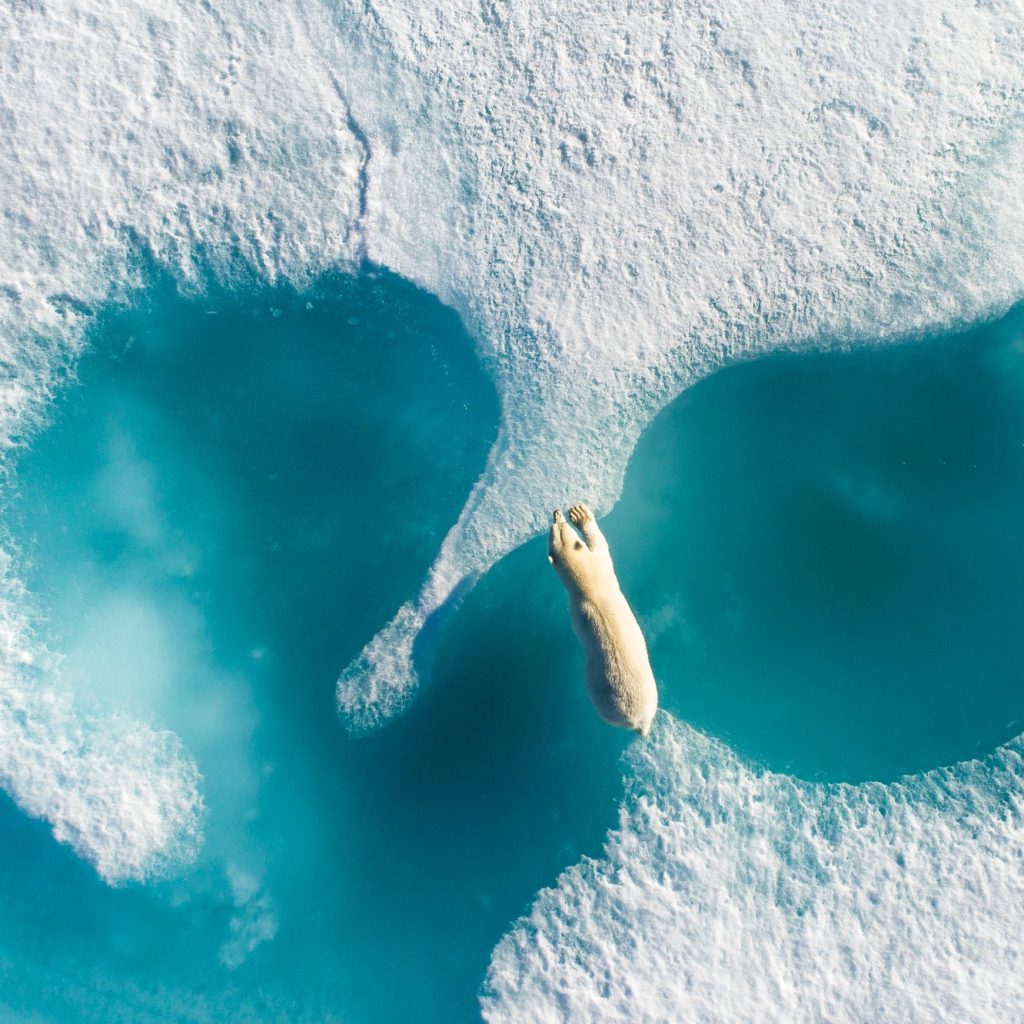
Until recently, visual surveys have been done from boats, planes and/or helicopters. In addition, baited remote underwater video systems (BRUVS) and subtidal acoustic-telemetry stations have allowed for tracking of marine megafauna in real time. However, the invention of drones, which are aerial photography systems, has made sampling easier than ever before. Drones have also improved the workplace safety by reducing fatality risk, and visual and auditory impacts for wildlife and people.
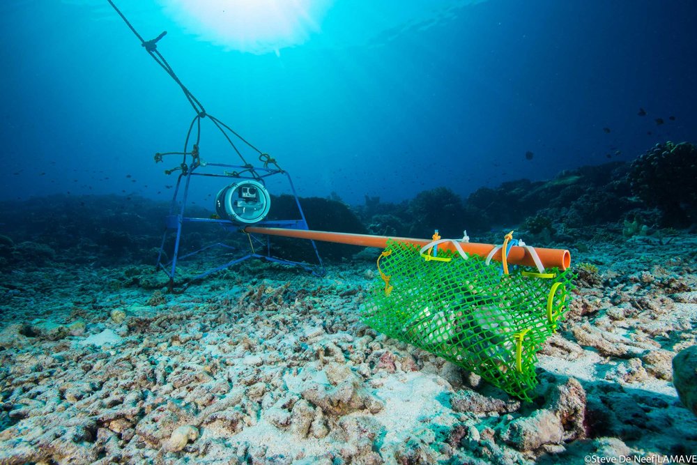
Credit: Lamave
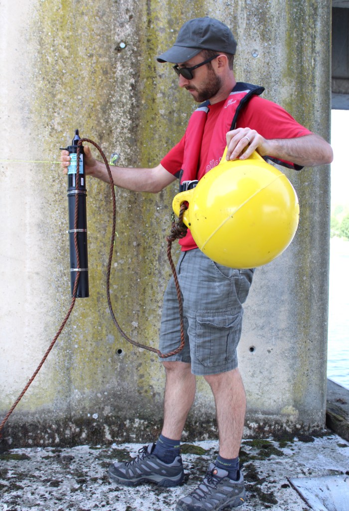
Credit: Profish
In one study, researches have used drones to track the variable assemblages of megafauna on the eastern coast of Australia and they have been able to identify 4388 individuals from 216 drone flights, estimating high wildlife richness and abundance, mainly near estuarine environments characterised by higher food load. But are drone visual censuses really as simple as that? Although the research group had succeeded in this assessment, they discussed a few technical troubles. One of them was limiting drone surveys to days when the water clarity was high. Sun glare and sea state had also influenced the detectability of large marine fauna.
Another research team used drones to patrol the shark presence and therefore reduce the risk of shark attacks. In the study, they presented a few interesting and much more technical aspects, like the fact that drones can operate at individual beaches, can fly constantly at lower airspeeds and altitudes, and can facilitate viewing in real time due to polarising filters. Not to forget the hyperspectral sensors that allow us to enhance images in order to see through different layers of the water column, in other words, to see something that the human eye cannot.

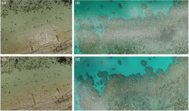
Due to an increased interest in learning how to operate drones for scientific purposes and since acquiring aerial footage is usually harder than thought, experts have written proper guidelines. Sometimes, it is necessary to work in remote locations and the available time is short, so it is essential to understand how to obtain drone-based data. One example can be seen below, where all four images represent the same locations and same time. Figures a and b are worse than c and d, but why? It is because of the sun glint and because of the fact that the first two were taken in nadir (direction pointing directly below the observer, in this case drone), whereas the second two were taken at a slight angle, minimising therefore the sun glint.
Progress in technology will allow us – scientists – to explore and dicsover with ease what was thought impossible even ten years ago. If I am already stunned now, I cannot imagine what inventions will come out in the years to come. Can you imagine? Reaching the depths in no time and safely? Or seeing through from the air, seeing so well to be able to classify and quantify the wildlife? Hearing the entire ocean basins speak to us? Mind blowing.
Kelaher, B.P., Colefax, A.P., Tagliafico, A., Bishop, M.J., Giles, A. and Butcher, P.A., 2019. Assessing variation in assemblages of large marine fauna off ocean beaches using drones. Marine and Freshwater Research, 71(1), pp.68-77.
Joyce, K.E., Duce, S., Leahy, S.M., Leon, J. and Maier, S.W., 2019. Principles and practice of acquiring drone-based image data in marine environments. Marine and Freshwater Research, 70(7), pp.952-963.
Butcher, P.A., Piddocke, T.P., Colefax, A.P., Hoade, B., Peddemors, V.M., Borg, L. and Cullis, B.R., 2020. Beach safety: can drones provide a platform for sighting sharks?. Wildlife Research, 46(8), pp.701-712.
